


Winter storm setup

A strong post-Thanksgiving storm is tracking from the Plains into the Great Lakes, spreading a swath of accumulating snow across the Ohio Valley and western Great Lakes through Saturday night. Cold air already in place over Ohio will allow most of the precipitation to fall as snow, with the heaviest bands aimed at northwest and north-central parts of the state.
Advisory vs. warning areas

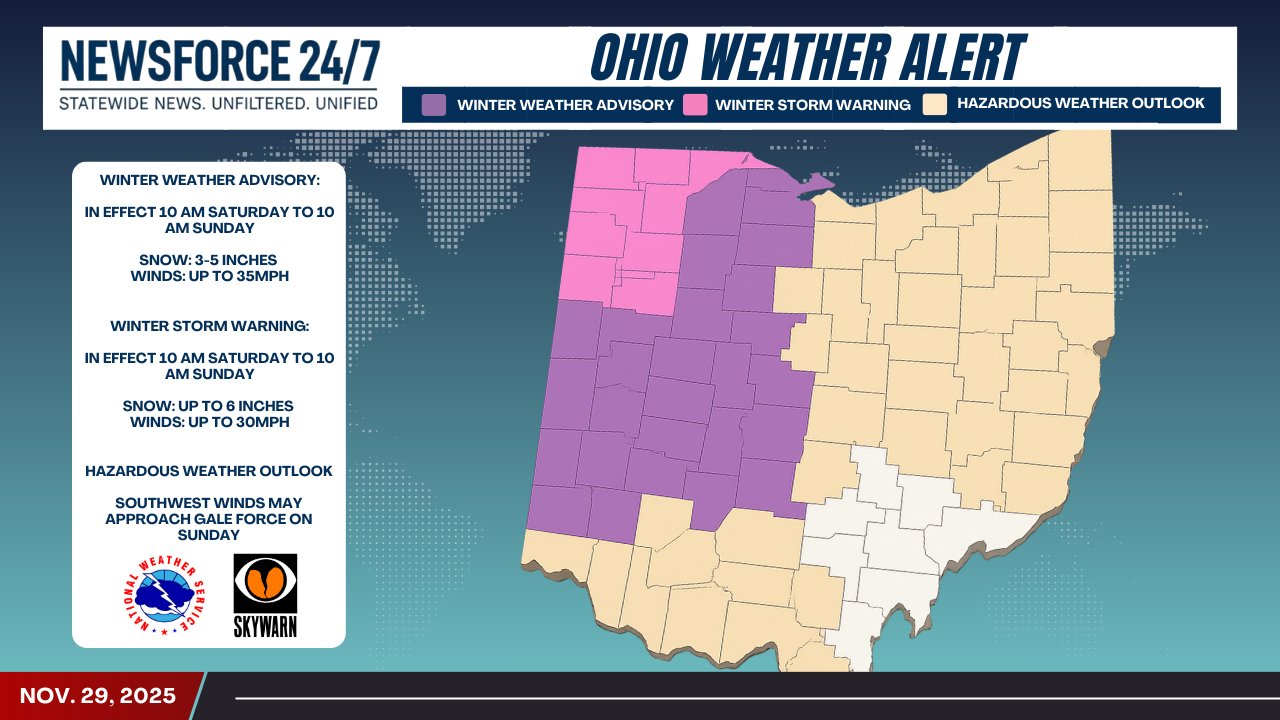
Counties shaded purple on the NewsForce247.com map are under a Winter Weather Advisory, where the National Weather Service expects 3 to 5 inches of snow and wind gusts up to 35 mph, leading to slick roads and reduced visibility. The brighter pink band along far northwestern and north-central Ohio is under a Winter Storm Warning, with snowfall totals up to 6 inches and wind gusts to 30 mph likely to create more significant travel disruptions.
Southern and eastern outlook

Much of southern and eastern Ohio, highlighted in tan, is covered by a Hazardous Weather Outlook rather than formal winter storm headlines. In these areas, lighter snow or a wintry mix is possible, but the bigger concern comes Sunday as strengthening southwest winds may approach gale force, especially in exposed and higher terrain.
Travel and safety impacts

State and local transportation officials warn that road conditions could deteriorate quickly Saturday afternoon and evening, particularly along major corridors feeding into the Toledo metro and across central Ohio where advisories are in place. Drivers are urged to slow down, allow extra stopping distance, and be prepared for sudden drops in visibility in heavier snow bands and blowing snow.
What residents should do
Forecasters recommend that residents in the warning and advisory zones complete errands early Saturday, secure outdoor items vulnerable to strong winds, and keep an emergency kit in vehicles in case of delays. Boaters and those along Lake Erie’s shoreline should stay alert for rapidly building waves and potentially gale-force southwest winds on Sunday that could make conditions dangerous on the water and along piers.