


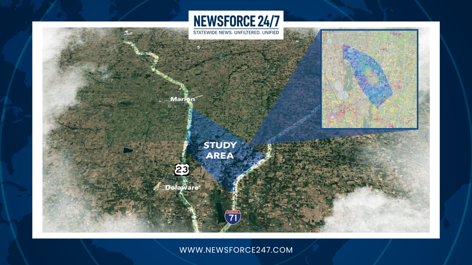
The idea of directly linking U.S. 23 and Interstate 71 isn’t new — but for the first time in decades, state transportation officials believe it may finally happen. The Ohio Department of Transportation (ODOT) is deep into a new study exploring a long-discussed connector between the two major north–south routes, a project once deemed unfeasible but now revived under mounting congestion and renewed economic pressure.

In the late 1980s and early 1990s, ODOT studied a similar concept, weighing “Eastern” and “Western” bypass options to ease traffic along U.S. 23. Those earlier studies found that while such a connector was physically possible, the costs and environmental impacts were too steep. Concerns about farmland loss and budget constraints ultimately shelved the idea in favor of smaller improvements along the existing U.S. 23 corridor — incremental fixes that have since fallen behind the region’s rapid growth.
“Those early efforts are essentially the foundation of what’s happening now,” ODOT officials note in current reports. “The conditions have changed dramatically since then, both in terms of traffic volume and technological capability.”

Where the previous study was driven by regional growth forecasts, today’s “Route 23 Connect Study” is being propelled by what officials call “crisis-level congestion.” U.S. 23 now carries nearly 30% more traffic than it was designed for, creating daily bottlenecks across Delaware County as commuters and freight traffic vie for limited roadway capacity.
The new effort — a $2 million feasibility study mandated by the Ohio Legislature through House Bill 23 — has narrowed an initial pool of 16 potential routes down to a handful of “most promising” alignments, most located north of Ashley near the Delaware, Marion, and Morrow county lines. ODOT expects to submit its final report and preferred route alternative to state lawmakers by October 1, 2026.

While the estimated cost of a modern connection ranges from $858 million to $1.6 billion, officials now view it as a strategic investment. Freight planners see the project as a critical link in what’s being called the “Toledo-to-Columbus” logistics corridor — one that connects international freight entering through Michigan and Canada with central Ohio’s booming distribution network.
Advances in mapping and environmental analysis have also changed the conversation. Today’s study uses high-resolution GIS modeling to pinpoint wetlands, family farms, and sensitive cultural areas, allowing planners to minimize disruption more precisely than the earlier broad-brush proposals.

The discussion has also expanded beyond the corridor itself. Some have suggested that State Route 30, a nearly completed freeway stretching across northern Ohio, could serve as part of the long-term freight solution. But ODOT acknowledges that U.S. 30’s success in speeding up east–west truck travel has only worsened bottlenecks at U.S. 23, where that freight flow eventually slows to a crawl southbound toward Columbus.
“The two projects are really siblings,” an ODOT planner explained during a recent public workshop. “Finishing U.S. 30 created the very pressures that now make the 23/71 connection essential.”
Public feedback sessions will continue through summer as the study team refines its preferred route. If approved, the connector would mark one of the largest highway projects in central Ohio in decades — and potentially the final missing link in a freight network that’s been forming since the turn of the century.