


Severe storms possible statewide
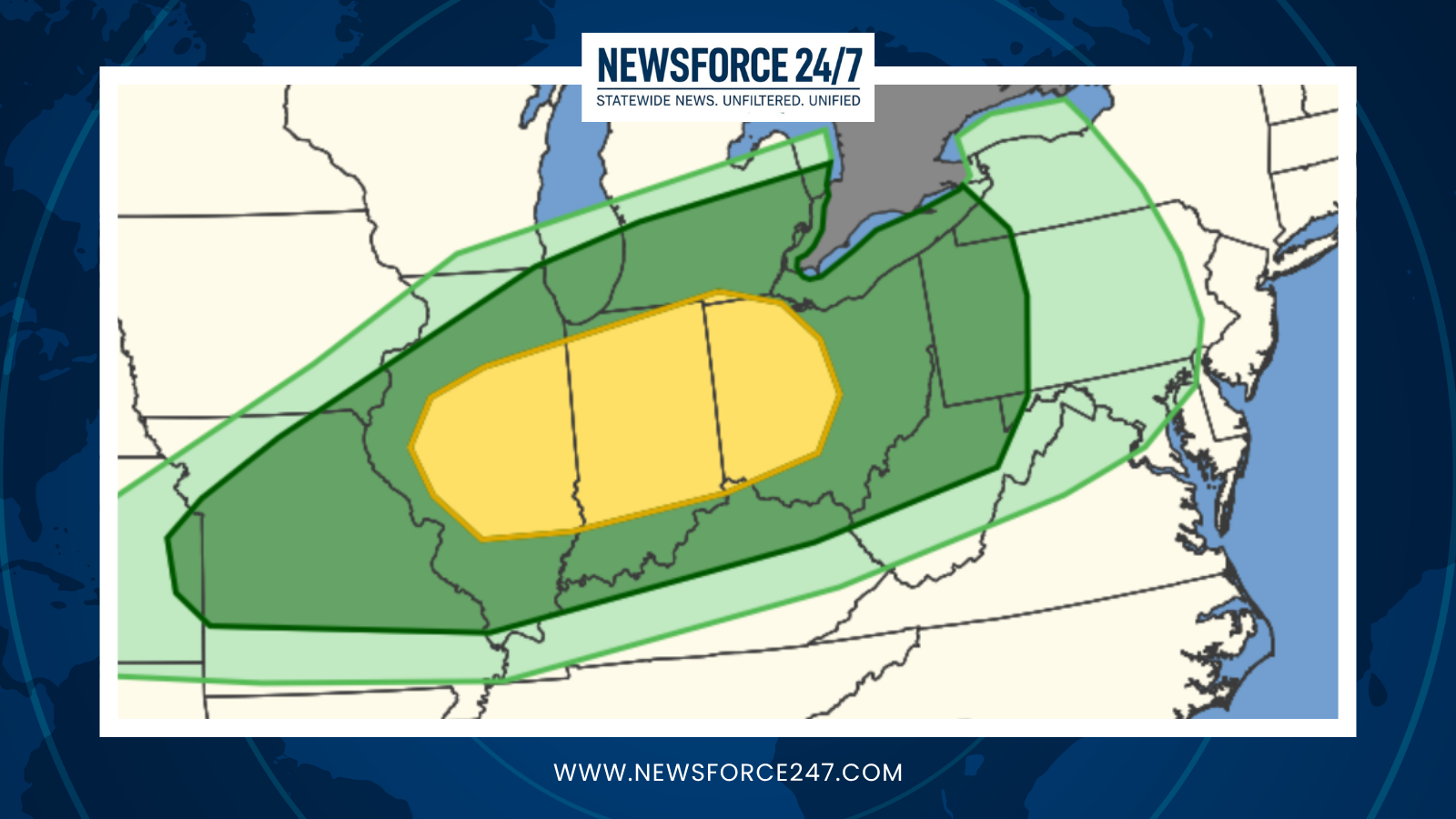
Forecasters say the entire state is under a risk for severe thunderstorms late Thursday as a powerful storm system approaches from the west. Western Ohio faces the greatest concern, where the Storm Prediction Center has outlined a Level 2 out of 5, or “slight,” risk for severe storms. In practical terms, that means scattered strong to severe storms are possible, with some capable of producing significant impacts.

At this point, very large hail and damaging wind gusts appear to be the primary hazards with Thursday’s storms. An isolated tornado or two cannot be ruled out, especially in any stronger, more organized cells that can tap into increasing wind shear during the evening and overnight hours.
Timing and impacts
Storms are expected to develop to the west during the latter part of the day Thursday, then move into Ohio late in the afternoon and especially Thursday night. The exact timing and intensity will depend on how much warmth and humidity can build ahead of the front, but residents should be prepared for quickly changing conditions after sunset.

Damaging straight-line winds could down trees and power lines, leading to scattered power outages, while large hail may cause damage to vehicles and roofs. Localized flooding is also possible in areas that see repeated thunderstorms or heavier downpours. Because some of the strongest storms may arrive after dark, officials urge extra caution for those traveling Thursday night.
Start of an active season
Thursday’s threat comes as Ohio heads into its primary severe weather season, which typically runs from spring into early summer, when the combination of increasing warmth, moisture, and stronger upper-level winds favors more frequent rounds of thunderstorms. This period often brings an uptick in reports of hail, damaging winds and, on occasion, tornadoes across the region.

Emergency managers recommend using this early-season event as an opportunity to review severe weather plans at home, work, and school. That includes identifying your safest shelter location, checking batteries in weather radios, and making sure mobile devices are set to receive weather alerts.
Preparedness and next steps
Residents are encouraged to monitor updated forecasts through Thursday, as threat levels and timing may be refined in the coming days. If watches or warnings are issued, people in the path of storms should move indoors immediately and avoid windows, especially during periods of high wind or large hail.

News and weather teams will continue to track this developing system and provide updates as new forecast information becomes available. Stay tuned on air, online and via mobile alerts as Ohio’s severe weather season gets underway.