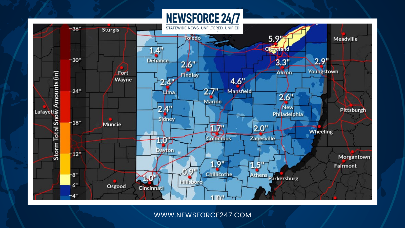

Ohioans should prepare for a chilly weekend marked by significant snow across the state, according to weather forecasts. Moderate to heavy snow showers are expected to impact travel and outdoor plans.
Snow Arrival Timeline
Snow will arrive statewide on Sunday, February 22, with moderate or heavy snow showers forecasted. The National Weather Service data, as reflected in detailed projections, indicates accumulations of about 3.3 cm (1.3 inches) that day.

Light snow will continue into Monday, February 23, adding roughly 0.3 cm (0.1 inches), though the weekend focus remains on Sunday’s heavier event. These patterns align with February’s typical 14 snowy days, cooler than average temperatures around 30°F, and this weekend’s drop to 1°F highs and -2°F lows.
Regional Breakdown
Northern Ohio, including Cleveland (5°F/-3°C) and Toledo (5°F/-1°F), faces the brunt of Sunday’s showers amid overcast skies. Central areas like Columbus and Dayton (3°F/-3°F) will see similar snow onset by late morning, transitioning to flurries.

Southern regions, such as Cincinnati (2°F/-4°C) and Athens (4°F/-3°F), expect steady snow from midday Sunday, with lighter totals but slippery roads. Eastern spots like Youngstown (4°F/-2°F) and Canton mirror this, with 3.3 cm possible.
Western Ohio near Sandusky (8°F/0°C) may see slightly less intensity but still warrants caution.

Impacts and Prep
Travel disruptions loom, especially Sunday afternoon, as temperatures stay below freezing. Power outages from heavy, wet snow are possible in rural counties.
Officials urge checking road conditions via ODOT and stocking essentials. Warmer trends follow midweek, but this weekend demands winter readiness.